Paraglidingspots.com is a non-profit website for paragliding (and hanggliding) pilots who want to discover new flying areas.
The Google Earth version offers 3D terrain view and the possibility to load and view XC cross country flights lead to a quick understanding of the areas.
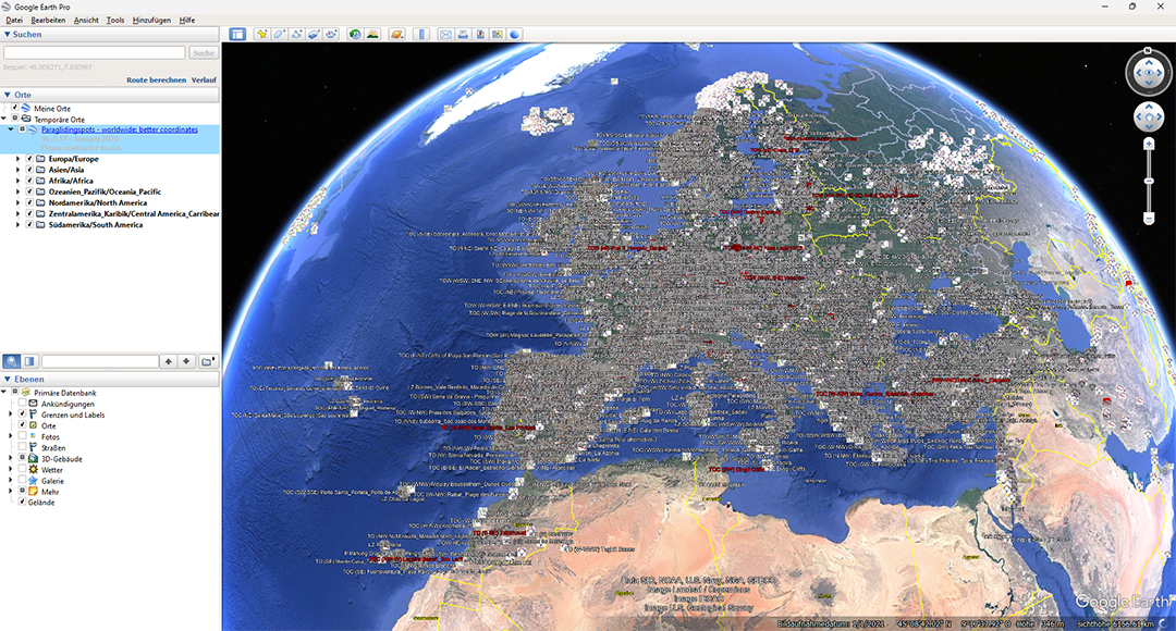
With a simple download you get a free of charge / free of advertisement database with over 38.000 international launches and landing zones - for 3D browsing with (pre-installed) Google Earth Pro.
The online version is 2D only, but better for filtering or finding specific spots, e.g. by rating or wind orientation, and directly navigate to each spot with your smartphone.
Additionally, you can download waypoint files for GPS navigation instruments.
With paraglidingspots.com you get the complete picture, worldwide.
Info
One of the nice things paragliding offers is to explore new sites and countries. When scouting around with your wing, you want to avoid to drive around for nothing. The coordinates should be correct. You might also want to evaluate which sites are interesting for you or not. Site research in the internet can be time-consuming and sometimes frustrating. For example, coordinates of many sites are misreported, or you are not able to separate popular from rarely used sites.
Paraglidingspots.com collects / researches information from various sources. The goal is to offer all flyable sites at one glance, worldwide, and above all: reliable coordinates.
|
|
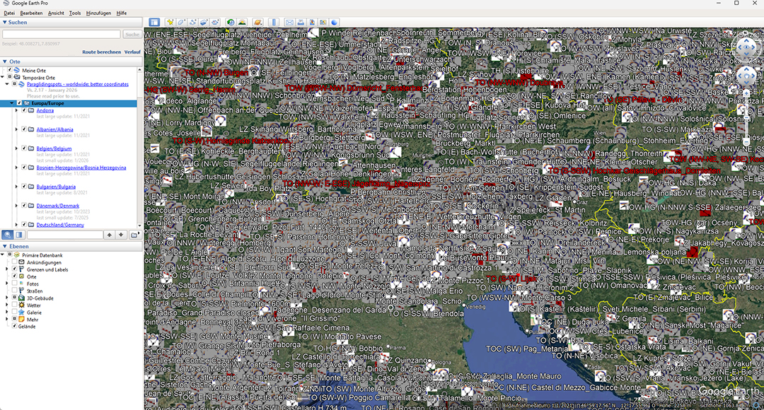
Red coloured text means: good spot, you should try if you are around. Red coloured symbol means: very frequented, super spot.
- Install the program Google Earth Pro. If possible, use a computer with good performance, and a fast Internet connection.
- Suggestion: activate only the following layers: places / boarders / photos / mountains (to view 3D) in the beginning. Eventually also streets. Unclick all other layers, otherwise the buildup might be slow and shows too many details.
- Load the paraglidingspots database, it will open up automatically with Google Earth. (PLEASE NOTE - opening of the file for the first time will take some time, be patient. After you have saved it on your computer, it is much faster at next program start.) To further speed up working with GE, maximise the usable cache under 'Tools/Options'.
- Once the database is opened in Google Earth
- deactivate all countries and sites on the left column of you Google Earth window which you do not need (click away the hooks - you can always reactivate them)
- zoom in where you want to go to see details and help loading time. Leave the program some time to load
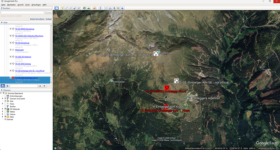
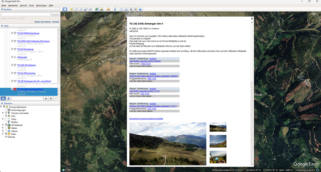
- click with the left mouse button on an icon. A window with further site info will open.
- Regularly check the NEWS section and load updates.
PLEASE NOTE - when uploading a new database you should eliminate the old version, and shift the new one from 'temporary' to 'my places' - otherwise you will have copies of each spot, and you do not know which are new.
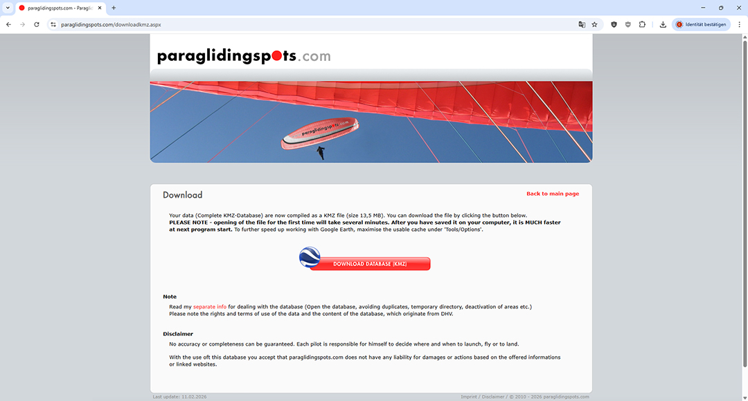
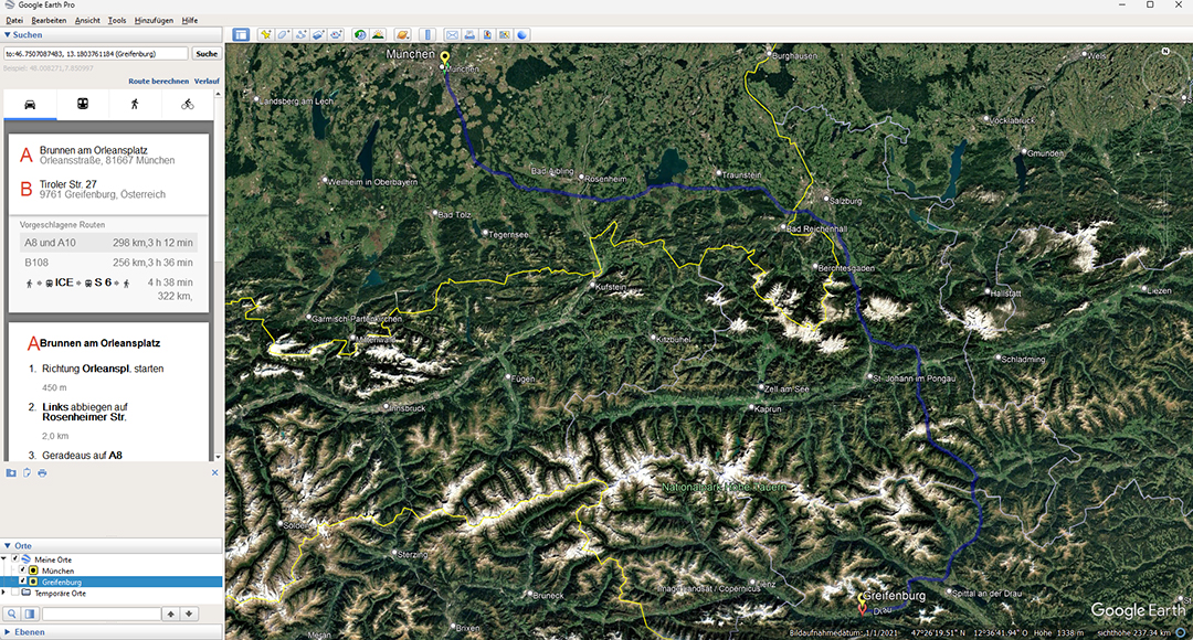
Download database
Open database with
Google Earth
Choose a region
Zoom in
Left click:
description of flying area
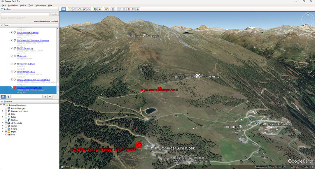
Track area in 3D
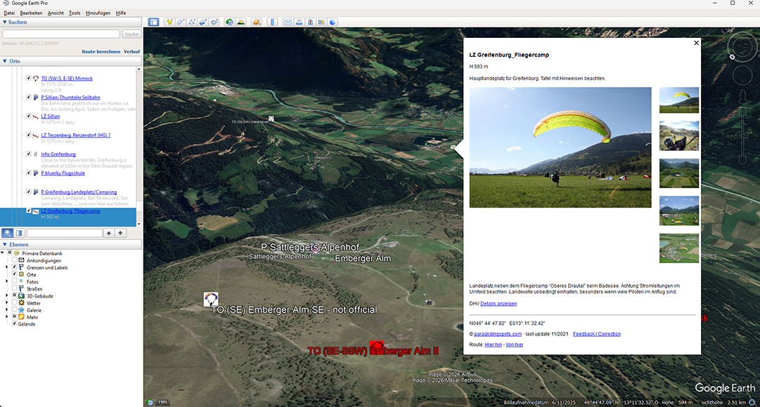
View landing site
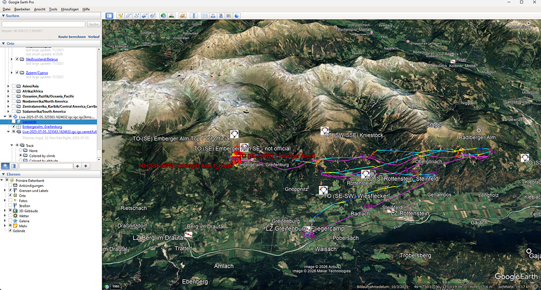
Load and fly distance flights
Calculate approach
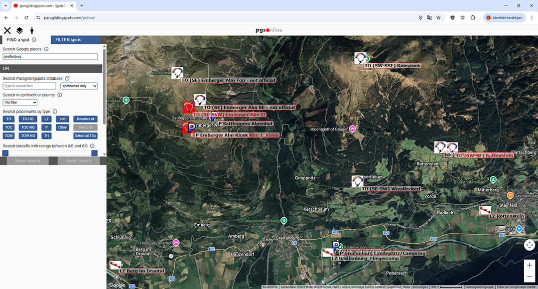
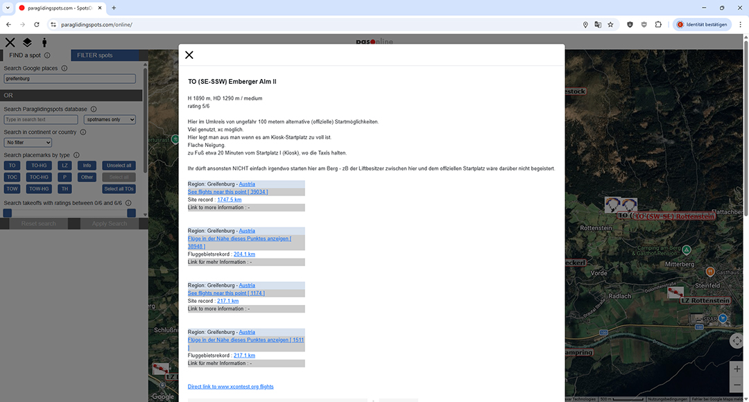
- Click https://paraglidingspots.com/online/.
- Switch on geolocation if possible.
- Meaning of the symbols
- Open the menu window to find or filter the spots
- Close the menu window used to find or filter spots
- Change of map type (Standard / Terrain / Satellite)
- Center map on your location
- There are 3 main options to go forward
- Direct browsing by shifting the map, zooming and clicking the spots you are interested in.
- Finding a specific spot (default)

e.g. Search Google places:
type in „Greifenburg“ / RETURN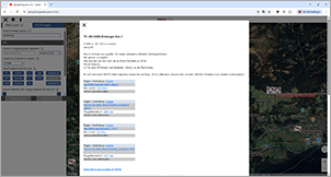
Click on an icon or name:
View detailed information - 3. Filtering, e.g. by country: „Portugal“ and all takeoffs with a rating of 4/6 to 6/6
The online version is still beta – you will have to play around a bit to find all the functions. If you find any bugs or have suggestions to improve please send an email to info@paraglidingspots.com.
Paraglidingspots is admin created, based on various sources.
Users are encouraged to provide feedback using the button at the end of each spot, or drop an email to info@paraglidingspots.com.
- Main sources are
- flightlogs (e.g. xcontest.org) providing evaluation of takeoff/landing coordinates, popularity and suitablity for type of flight and xc or thermal / soaring options, launch orientation etc.
- National Free Flight organisation websites (e.g. dhv.de)
- Various other websites (e.g. clubs, schools, tandem operators, travel guides, blogs, PG magazines)
- Publicly available picture and video sources
- Ideally, each spot in the database provides these information:
- GPS coordinates, launch and landing
- spot names / alternative names
- launch orientation
- height of launch, height difference to landing
- difficulty of launch or landing
- rating 0/6 to 6/6
- type of flight: mountain/coast/towing – training/soaring/thermalling/xc...
- flightlogs
- pictures and video links
- How to get there / how to get up
- suitable for whom
- hints, dangers, contacts, links
Why is it so difficult to get these data?
National Free Flight Organisations: due to their policy many of them do not want you to know – Ireland, Denmark etc. They say, too many foreign pilots misbehaved, so they want you to contact the locals and get the information by yourself.
As travelling pilots will find the good spots anyway, this is counter productive. If all associations would be transparent stating the no-go’s and dangers of each spot, many conflicts and problems could be avoided.
Clubs, schools, tandem operators, travel guides, magazines mostly do not have interest to provide conclusive data. They want to protect their spots, maximise their business.
That is the reason for paraglidingspots.com, to give you the basic picture.
It will be always neccessary to contact the locals prior to flying, know and adhere to the rules.
In many countries people do not use websites to spread infos but just fly, locally. So if you have good new sources, please drop me a mail!
Have fun, be safe ... and see you up there